
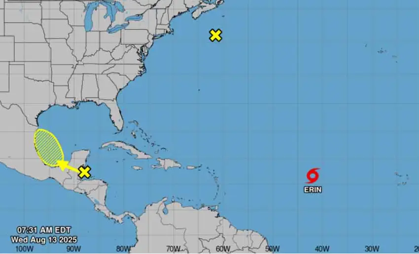
Tropical Storm Erin continues to move westward through the central Atlantic. With maximum sustained winds of 75 kilometers per hour (km/h), the National Hurricane Center reported today.
The scientific institution has issued a storm watch for the northern Leeward Islands, the Virgin Islands, and Puerto Rico. Which will experience severe swells in the coming days. Likely to cause life-threatening surf and rip current conditions.
The system is now located near latitude 16.5 North, longitude 41.9 West and is moving westward near 31 km/h (19 mph). This general motion is expected through Thursday, with a west-northwestward motion beginning tonight and continuing into the weekend.
On the forecast track, the center of Erin is likely to move near or just north of the northern Leeward Islands through the weekend.
The report forecasts gradual strengthening today and that it will likely become a hurricane late Thursday or early Friday.
With information from Prensa Latina
Latest posts by Radio Angulo (see all)
- Delcy Rodríguez provides an update on earthquake damage in Venezuela - 27 de June de 2026
- UN: Cuba’s resounding victory over the US in the WFP - 27 de June de 2026
- Díaz-Canel Declares Priorities for the Labor Movement and the Economy - 27 de June de 2026