
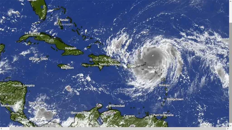
Hurricane Erin is advancing northwestward this Monday with a Category 4 storm on the Saffir-Simpson scale. With maximum sustained winds of 215 kilometers per hour (km/h). Another hurricane could develop in the Atlantic in the coming days.
The first hurricane of the current hurricane season was located near latitude 23.1 North, longitude 70.5 West, moving at 20 km/h (12.5 mph). It could gradually turn northward late today and Tuesday.
The National Hurricane Center notes that Erin’s core could pass east of the southeastern Bahamas today and move between Bermuda and the east coast of the United States by midweek.
Its hurricane-force winds extend outward up to 130 km (80 mi) from the center, and tropical-storm-force winds extend outward up to 370 km (230 mi).
The scientific institution also warns that a tropical wave located over the eastern tropical Atlantic is producing disorganized showers and thunderstorms.
Environmental conditions appear favorable for the gradual development of this system. A tropical depression could form during the latter part of the week.
This system should move westward to west-northwestward at approximately 32 km/h (20 mph) across the central tropical Atlantic and approach the vicinity of the Leeward Islands toward the end of the week.
With information from Prensa Latina
- Moonlight That’s Always There (This article contains spoilers for the film Moonlight) - 17 de June de 2026
- Strategic Management for Territorial Development Evaluated in Holguin Municipalities - 17 de June de 2026
- Codanza, thirty-four years of heart and soul in the city of parks - 17 de June de 2026