
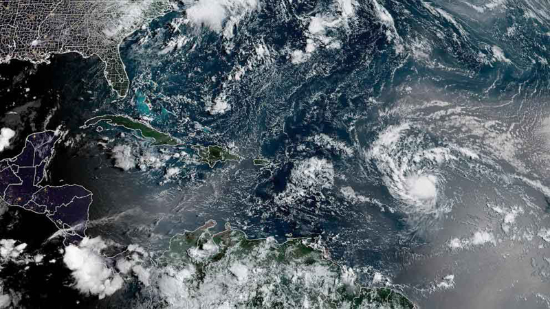
Erin became the first hurricane of the season this Friday with winds of 120 km/h (75 mph). According to the latest forecast from the U.S. National Hurricane Center (NHC), its continued and rapid strengthening is expected.
It continues its path over the Atlantic Ocean, with torrential rains expected over the next two or three days. Erin is also forecast to become a major hurricane over the weekend, according to the source.
It is currently moving near latitude 18.2 North, longitude 56.1 West toward the west-northwest near 30 km/h (19 mph).
According to the forecast, monitoring indicates that maximum sustained winds have increased to near 120 km/h (75 mph) with stronger gusts.
Hurricane-force winds extend outward up to 35 km (22 mi) from the center, and tropical-storm-force winds extend outward up to 185 km (115 mi). Primarily north of the center, the U.S. National Hurricane Center said in a statement.
Erin’s outer bands are expected to produce areas of heavy rain tonight through Sunday in northern Leeward, the Virgin Islands, and Puerto Rico.
According to caribbeannewsdigital, Hurricane Erin will continue to strengthen in open Atlantic Waters. Bringing heavy rain, strong winds, dangerous surf, and rip currents.
The Windward Islands, Puerto Rico, the Virgin Islands, and parts of the Dominican Republic could experience localized flooding and storm surge beginning Saturday.
Although the center of the cyclone will not make landfall in these áreas. Its outer bands will cause hazardous marine conditions and possible transportation disruptions, according to this source.
With information from Prensa Latina
- Delcy Rodríguez provides an update on earthquake damage in Venezuela - 27 de June de 2026
- UN: Cuba’s resounding victory over the US in the WFP - 27 de June de 2026
- Díaz-Canel Declares Priorities for the Labor Movement and the Economy - 27 de June de 2026