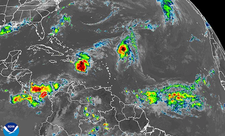
The Forecast Center has issued Special Advisory No. 1 due to the presence of an active tropical wave located in the eastern Caribbean Sea, near Hispaniola. This meteorological system, although still disorganized, is generating showers, rain, and thunderstorms currently affecting the Dominican Republic and Puerto Rico.
In the next 12 to 24 hours, the system is expected to move west-northwestward. Favoring the formation of a large area of low pressure near the Bahamas. Although its evolution is not yet clear, the proximity of this area of low pressure and the high humidity over the region will significantly increase the likelihood of precipitation in eastern Cuba.
Starting this Friday, the 26th, and continuing through the weekend, the provinces of Camagüey, Las Tunas, Holguin, Granma, Santiago de Cuba, and Guantanamo will experience unstable weather conditions. With numerous showers, downpours, and thunderstorms. Some of this rainfall could be heavy and intense in specific locations.
Moreover the Forecast Center recommends staying informed through official media. As a new Special Notice will be issued if conditions warrant.
With information from Cubadebate
Translated by Aliani Rojas Fernandez
- Another Mexican Ship with Aid Arrives in Havana - 28 de March de 2026
- Vandalism, a Silent Enemy in Holguin - 28 de March de 2026
- Solar Kits Illuminate Communities in the Turquino Plan - 28 de March de 2026